
A Lake View Is Not a Flood Assessment: How to Check Water Risk Before You Buy in Bengaluru
Two homes beside the same lake can carry very different water risk. Separate the source, path and reach, and keep an evidence register, not a score.
DesiAcres Editorial · 19 November 2026 · 8 min read
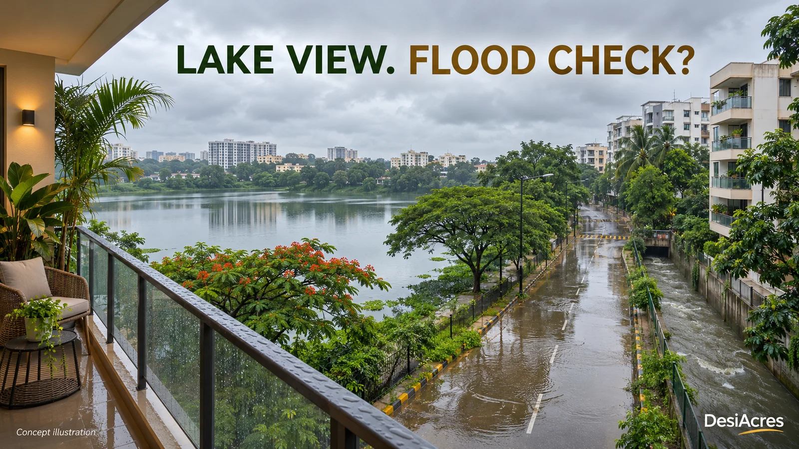
- A lake view tells you what you can see. It says nothing about where water goes when it rains hard.
- Split the question into source, path and reach. Water has to come from somewhere, travel somewhere and reach something you care about.
- Keep a flood evidence register: each finding with its source, its date and your confidence. "No report found" is not "no risk".
- Check the access road and the basement, not only the flat. A dry home with a flooded road is still a problem.
Two properties can be equally close to the same lake and have very different water risk. One sits on higher ground with a clear storm drain. The other sits in a low pocket where the road becomes a stream. The brochure photograph looks the same for both.
A useful assessment looks at the building, the approach road, the ground around them and the evidence available for each. This guide gives you a method and a format to record what you find. It does not predict floods, and a map cannot tell you what a drain will do in a record rainfall. What it can do is help you ask better questions and notice what is missing. For the basics of buffers and lake rules, start with our guide to buying near a lake in Bangalore, then come back here to build the evidence.
Separate the worries
"Flood risk" is a bundle of different problems. Name the ones you care about, because the checks differ.
- Waterlogging. Rain collects on a road or plot because drainage cannot keep up.
- Lake or tank overflow. A water body rises and spreads into the surroundings.
- Drain overflow. A storm drain or a rajakaluve (a primary drain) carries more than it can hold.
- Basement ingress. Water enters parking levels or lift pits.
- Access loss. The building is dry but the road to it is not.
You may be comfortable with some and not with others. A first-floor flat is not troubled by basement water. A family with a school run is troubled by an impassable road.
Source, path and reach
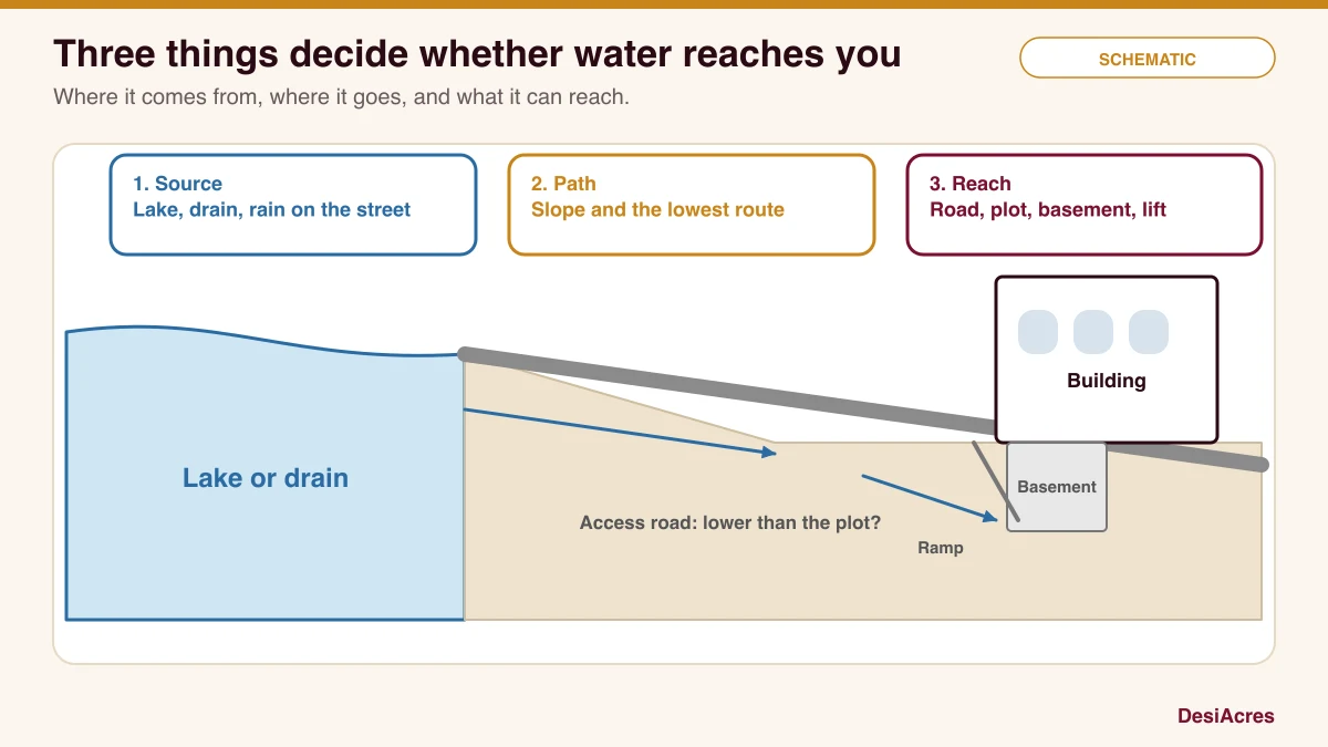
Work through each in turn.
- 1Source. Where could the water come from? A lake, a tank, a stormwater drain, a rajakaluve, an overflowing sewer, or simply rain on the street.
- 2Path. Which way does the ground slope? Water finds the lowest route. A pocket lower than its neighbours collects it.
- 3Reach. What would the water touch? The road, the compound, the ground floor, the basement, the electrical room, the lift pit.
A lake 400 m away with a rising slope toward your building is a different risk from a small drain 20 m away on the downhill side.
Find the water features
Mapped lakes and drains are your starting point, with caveats. Maps are made at a date, from a source, and they miss things. Note three details for every feature you rely on: the dataset, its date and what it leaves out. A drain that exists on the ground but not on the map is the usual surprise. Walk the area and look for culverts, concrete channels, grilles and low bridges.
The state disaster monitoring centre, KSNDMC, publishes weather and rainfall information that is useful for understanding local events. Master plan and zonal regulation documents set out buffers and restrictions, but they have been amended and the property's jurisdiction matters. Read them with a professional rather than alone.
Read the terrain
Elevation helps you reason about where water goes. Public elevation data is coarse, about 30 m in many places, so it shows broad slopes, not the lip of a kerb. Use it to ask: is the property higher or lower than the lake, the road and the nearest drain? Does the ground fall toward the plot or away from it?
Then verify by eye. After a heavy shower, stand at the property and look at where water collects and where it runs. If you cannot visit in the rain, ask neighbours, the watchman and local shopkeepers. They remember.
Check the access route
A home is more than its walls. Drive or walk the route you would use to reach a main road, a school and a hospital. Look for underpasses and low crossings, and for places where the road dips toward a drain. A basement parking ramp that faces downhill is an invitation. If the route floods, you may be unable to leave or return even though the building stays dry.
Look inside the building
In an existing building, you can ask for the things that tell the truth.
- Where does the basement drain, and is there a pump? Who maintains it, and when was it last tested?
- Are the electrical panels and the lift machinery above ground level?
- Has the association recorded any water entry? Ask to see minutes of meetings and complaint logs.
- Do the compound drains connect to a public drain that is clear, or to one that is blocked?
- Has the property been waterlogged in past monsoons? Ask three residents separately.
For a new project, ask to see the approved drainage plan, the sump and pump specification and the levels of the ground floor against the road. A reputable developer has these.
Read the history
Past events are strong evidence. Look for dated photographs, news reports with locations, official alerts and resident accounts. A single report is a lead, not a verdict. Two independent sources about the same street and the same date is strong. Record them all in your register, including the ones that go the other way.
Legal limits
Lakes, tanks and primary drains carry buffer zones, and building within them can be restricted or prohibited. The rules are specific to the water body and the jurisdiction, and they change. Check the current rules with a qualified professional for the property's exact location, and see our guide to rajakaluve and lake buffer checks. A property that sits inside a buffer is a legal risk as well as a water risk.
Keep a flood evidence register
Instead of reducing all of this to a score, write it down. A register shows what you found, where it came from and how sure you are. It also shows what you could not find.
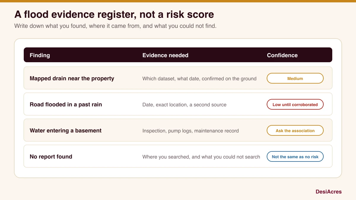
| Finding | Evidence you need | Your confidence |
|---|---|---|
| A mapped drain within 100 m | The dataset, its date and a visit that confirms it | Medium until seen |
| A report of road flooding | The date, the exact place and a second source | Low until corroborated |
| Water entering a basement | An inspection, pump logs and the association's records | Ask the association |
| No past flooding found | What you searched and what you could not search | Not the same as no risk |
Update it as you learn more. Show it to your advisor, your lawyer and your lender. A decision with a written register behind it is better than a decision made on a feeling.
A wet-weather visit sheet
If you can, visit during or just after a heavy rain. Bring a notebook and photograph with the date on.
- Where does water stand on the access road, and how deep?
- Which way does it flow at the property gate?
- Are the nearby drains full, running or blocked with rubbish?
- Does the basement ramp or compound show water marks?
- Does the building have a visible pump room, sump or overflow route?
- How does the road behave a few hundred metres on, toward the main road?
Handle what you cannot know
Some things stay uncertain. Rainfall in the future may differ from the past, and drains change with construction and maintenance. State your uncertainty plainly. "I found no incident and no mapped feature within 200 m, but my search could not cover X" is a good sentence. "It is safe" is not.
Write the conclusion
End with three lines: the evidence you found, your confidence in it, and the next step for each gap. If the register has several open items on source, path or reach, ask for more evidence or choose a different property.
Frequently asked questions
Is a lake view flat always a flood risk?
No. Many lake-facing homes have no water problem, and some inland ones do. What matters is the ground levels, the drainage and the access route. Check them instead of assuming.
Can a map tell me if a property will flood?
No. Maps show features and elevation. They do not predict how a drain or a lake will behave in an extreme rain. Use them to ask questions, then verify with a visit and records.
What should I ask a builder about drainage?
Ask for the approved drainage plan, the sump and pump details, the ground floor level relative to the road, and how storm water leaves the site.
What does "no incident found" mean?
It means your search did not turn up a report. It does not mean none occurred. Record what you searched so the next reader knows the limits.
How DesiAcres can help
Screen a location on GeoVerify to see nearby mapped lakes and drains with their sources, then use the results as the first lines of your register. Our checks point to what to ask. They do not replace a visit, a lawyer or an engineer.
- KSNDMC, Karnataka State Natural Disaster Monitoring Centre (ksndmc.org)
- BDA, Revised Master Plan 2015 zonal regulations (eng.bdabangalore.org)
- OpenCity, BDA Revised Master Plan 2015 documents (data.opencity.in)
- DesiAcres, Buying near a lake in Bangalore (desiacres.com)
Written by DesiAcres Editorial at DesiAcres Advisory Group, a Bengaluru buyer-side property advisory. General information, not legal or investment advice.
Run it through the free 15-point check, price vs comparables, red flags and a clear verdict.
Check a property →