
Buying a Plot in Bengaluru: How to Check Road Access Before You Pay a Token
You can drive to the plot today. Is that access recorded, wide enough and enough for what you plan to build? Check it in three separate layers.
DesiAcres Editorial · 19 November 2026 · 6 min read
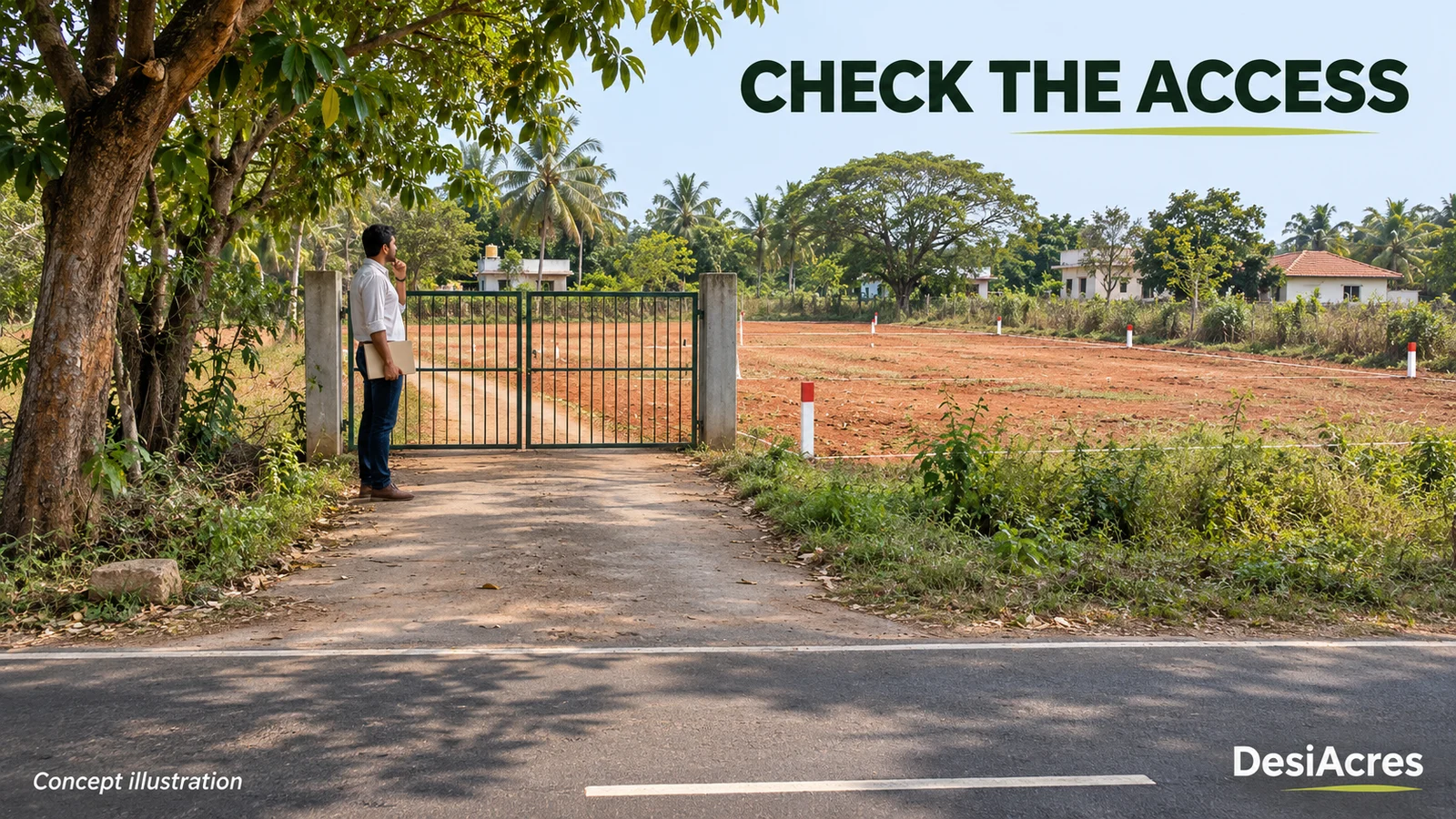
- Being able to drive to a plot does not give you a legal right to use the road. Physical access and documented access are different.
- Check three layers separately: what the map shows, what you observe on site, and what the papers support. Never merge them into one tick.
- A plot that touches a road on the map may still be cut off by a strip someone else owns.
- Missing access is the easiest problem to fix before you pay and the hardest after.
You can drive to the plot today. That tells you the access exists physically. The questions that matter next are whether it is documented, whether the width matches the records and whether it supports what you want to build. A plot with a perfect price and no lawful way in is worth much less than it looks.
This guide gives you a three-part check you can run before paying a token. It is practical guidance and not legal advice. Your advocate must read the papers, and a licensed surveyor must measure the land.
Physical access is not legal access
The dirt track to a plot may cross three other people's land. You are using it because nobody has objected yet. If the owner of one strip builds a wall, you are locked out. Your right to use a route has to come from a document: a public road, an approved layout, a recorded right of way or a deed that grants one.
Know which kind of access you have
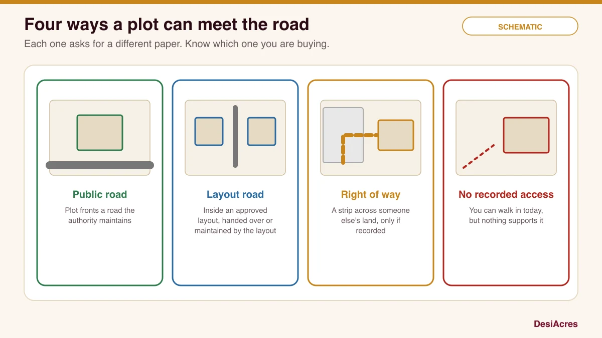
- A public road. The plot fronts a road the authority maintains. Look for the road in the approved plan or the revenue map.
- A layout road. The plot is inside an approved layout, and the roads are part of that layout. Ask for the approved layout plan and the handover or maintenance position.
- A right of way. The plot reaches the road through someone else's land. It should be recorded in a deed or an order, with a width and a description.
- No recorded access. You can walk in, but nothing supports it. This is the highest risk.
Three layers, kept apart
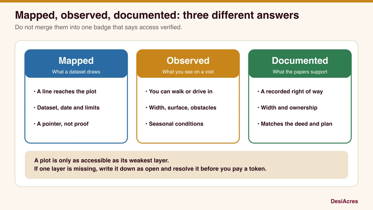
Layer one: mapped
What does a map show? Open a map and look for a road that touches the plot, noting which dataset it is from and its date. Mapped roads may be missing, outdated or drawn as a centre line. Our tools show the nearest mapped road and how much of a boundary faces one, but a map is a pointer. It cannot say who owns the strip between the road and the plot.
Layer two: observed
What do you see on site? Walk the approach.
- How wide is the road at the narrowest point, and what is the surface?
- Are there gates, walls, drains, electric poles or trees blocking it?
- Does it dead-end in a field, or reach a public road?
- How does it behave in rain? Is it a mud track that becomes a stream?
- Could a truck, a fire engine or a mixer reach the plot?
Measure and photograph with the date. Note the width in metres at three places.
Layer three: documented
What do the papers support? Ask your advocate to look for:
- the sale deed's description of boundaries and access;
- the approved layout plan with road widths marked, if it is in a layout;
- any registered right of way or easement deed, with width and parties;
- the revenue records for the strip between the plot and the road;
- any court orders or notices about the road.
Do the dimensions on paper match the width you measured? If the documents say 12 m and you measured 4 m, someone has built on it.
Look for missing links
Draw a line from the plot to the nearest public road on a printout. List every owner or authority whose land the line crosses. For each one, ask: where is the paper that lets me cross it? A single missing link breaks the chain.
Check planning, widening and reservations
Roads are planned and widened. A road may be marked for widening in the master plan, which could take a strip from your plot, and the width you can build back from changes. A reservation for a road, a park or a utility can reduce what is buildable. Zonal regulations set out frontage and setback rules by road width, so the width of the road that serves you affects what you can build. Ask a planning professional to read the master plan and the zonal regulations for the plot.
Seasonal and drainage conditions
A road that is fine in March can be impassable in August. Look for culverts, low crossings and drains along the route. If the access runs alongside a lake or a drain, the buffer and drain checks apply to the road as well as to the plot.
Does it suit what you want to build?
Access that is fine for a single house may not be enough for a gated layout, a small apartment block or a commercial use. Larger uses need wider roads, turning space and fire access. Decide your purpose first, and ask the planning professional what the access can support.
Questions to ask
- Will you show me the paper that gives access to the plot, and its width?
- Is the road in the approved layout, and who maintains it?
- Does any part of the route pass over land you do not own?
- Is any part of the road marked for widening or reservation?
- Is there any dispute or notice about the road or the strip?
Write the answers and the date. If an answer is vague, ask for the document.
Conditions to resolve before you commit
- A written confirmation of legal access with the document attached.
- A surveyor's sketch showing the plot, the road and the strip between them.
- Your advocate's note on the access in the title opinion.
- A clause in the agreement that makes the sale depend on access being confirmed, with a refund if it is not.
If any layer is missing, say so on the register and close it before the token.
Frequently asked questions
Can I buy a plot with no road access?
You can, but it is a serious risk. Without a recorded right of way, you may not be able to reach, build on or sell the land. Resolve access in writing before you pay.
Is a road on the map proof of access?
No. A map shows a feature with a date and limits. It does not show who owns the strip or whether you have a right to use it.
What is a right of way?
It is a legal right to cross another person's land to reach your own. It should be recorded with its width and the parties. Ask your advocate to read it.
Who should check the access?
Your advocate checks the papers, a licensed surveyor measures, and a planning professional advises on what the road width allows.
How DesiAcres can help
Check the mapped approach on GeoVerify, then verify the observed and documented layers yourself with the right professionals. Our screen shows the nearest mapped road, which is the first layer only.
- Bhoomi, Karnataka land records (landrecords.karnataka.gov.in)
- Kaveri, registration and encumbrance services (kaveri.karnataka.gov.in)
- BDA, Revised Master Plan 2015 zonal regulations (eng.bdabangalore.org)
- DesiAcres, Rajakaluve and lake buffer screening (desiacres.com)
Written by DesiAcres Editorial at DesiAcres Advisory Group, a Bengaluru buyer-side property advisory. General information, not legal or investment advice.
Run it through the free 15-point check, price vs comparables, red flags and a clear verdict.
Check a property →